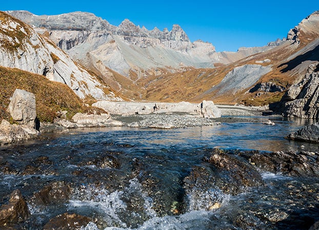
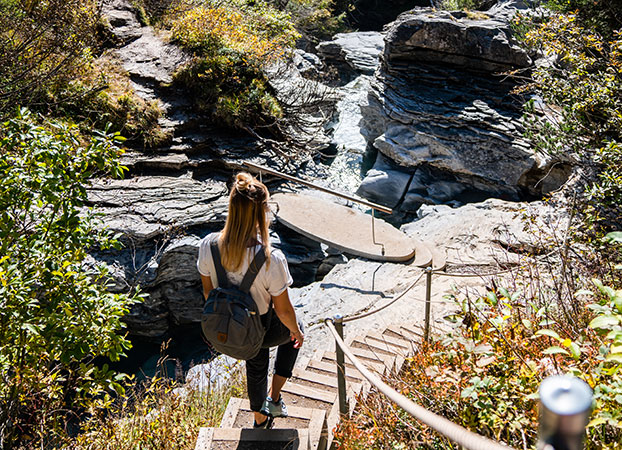
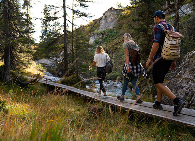
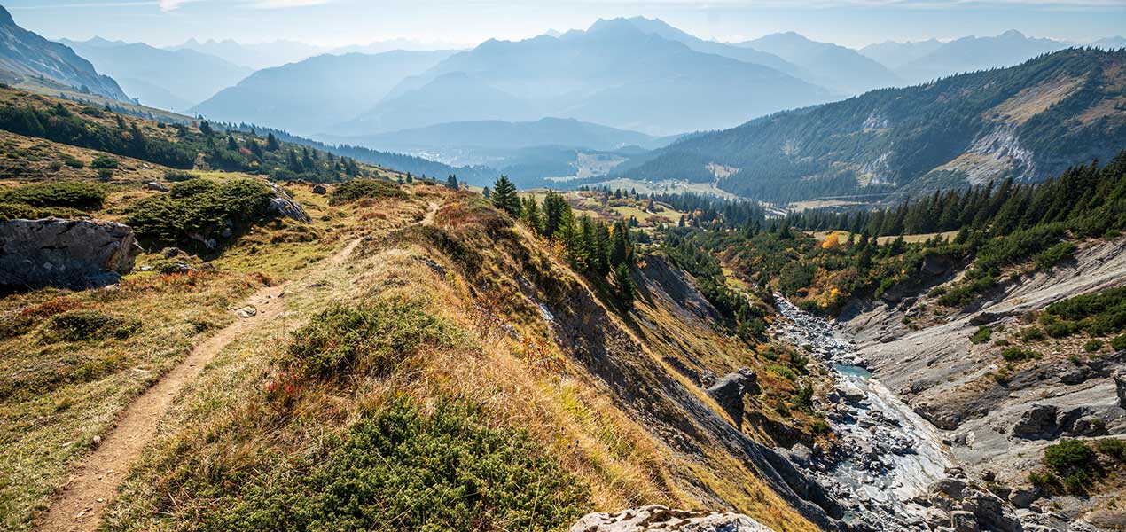
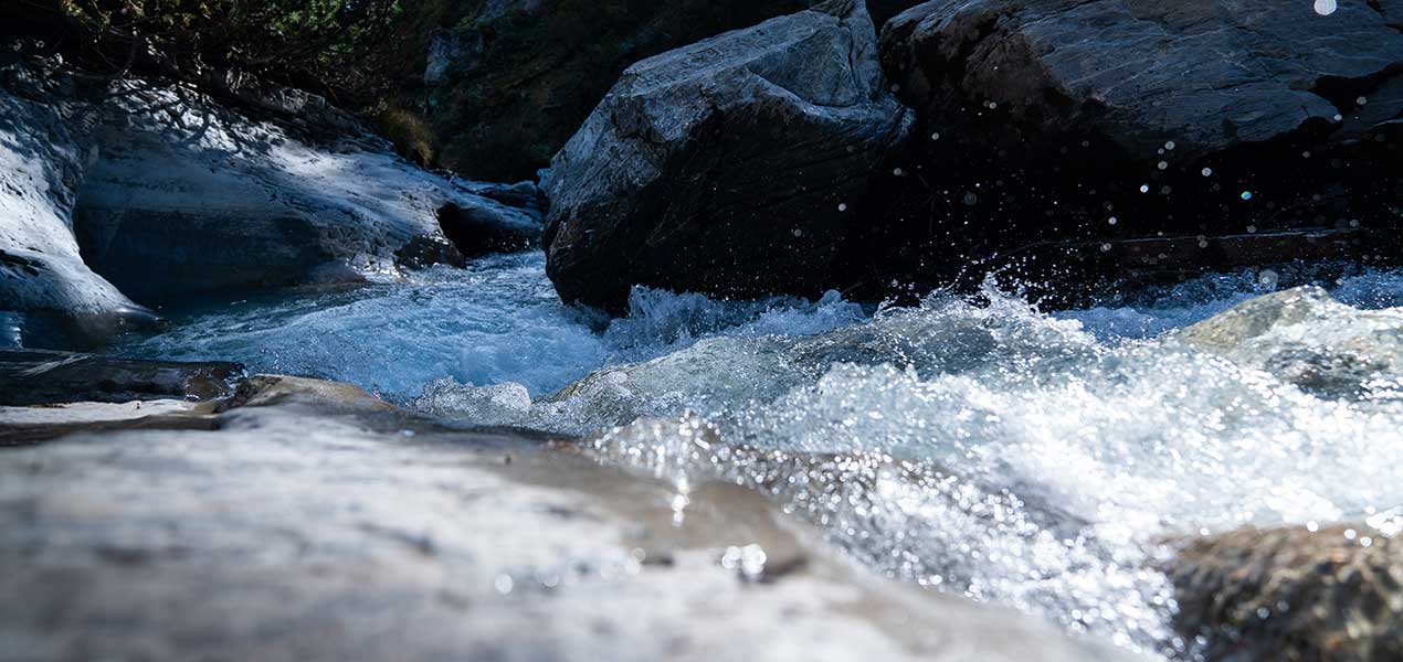
The award-winning Flims water trail leads you down from the source of the Flem stream in upper Segnesboden, past a unique ravine landscape to the town centre of Flims. You will cross seven bridges, some of them based on audacious designs by the famous bridge builder from Graubünden, Jürg Conzett. From here, you can savour views of the bizarre rock formations in the gorge of the Flem and take in the noise of the wild mountain stream. Those who like to take things easier can follow the course of the Flem down to the valley. More ambitious hikers can take on the ascent in the opposite direction.
This is a placeholder for third party content, please click to activate.
The external provider might be able to collect user specific data by activating this content. For more information please check out our data protection.
The trail is also suitable for less experienced hikers. It is divided in several sections with multiple options to enter or exit the main trail.
|
Route |
Distance |
Time |
|---|---|---|
|
Alp Nagens Stalla - Segneshütte - Flims valley station |
10.4 km |
4:15 h |
|
Scansinas - Panoramaweg - Flims valley station |
11.3 km |
4:30 h |
|
Flims valley station - Punt Gronda - Flims valley station |
3.8 km |
1:40 h |
|
Flims valley station - Punt da Max - Flims valley station |
7.1 km |
3:05 h |
|
Nagens mountain station - Segneshütte - Foppa - Flims valley station |
14.3 km |
4 h |
|
Flims - Segnesboden - Grauberg - Runcahöhe - Flims |
22.2 km |
9:35 h |
|
Route |
Distance |
Time |
|---|---|---|
|
Starting point Wasserweg Waterfall - Intersection Segneshütte |
1.0km |
20min |
|
Intersection Segneshütte - Segneshütte |
0.6km |
10min |
|
Segneshütte - Punt Desch |
2.2km |
45min |
|
Punt Desch - Punt da Max |
2.6km |
1h |
|
Punt da Max - Punt Gronda |
1.8km |
35min |
|
Punt Gronda - Starting Point Wasserweg Base Station |
2.0km |
40min |
|
Route |
Distance |
Time |
|---|---|---|
|
Runcs (PP) - Punt Gronda |
1.0km |
20min |
|
Foppa - Punt da Max |
1.0km |
15min |
|
Foppa - Bridge Tarschlims |
1.0km |
25min |
|
Naraus - Punt Desch |
1.4km |
25min |
|
Naraus - Intersection Segneshütte |
3.5km |
1h 10min |
|
Alp Nagens Stalla - Segneshütte |
1.6km |
40min |
|
Nagens mountain station - Starting point trutg dil flem waterfall |
4.6km |
1h 20min |
|
Grauberg - Segneshütte |
1.0km |
15min |
If you want to walk the Trutg dil Flem from the mountain down to the valley, you start at the lower Segnesboden in the middle of the UNESCO-World Heritage Site Sardona near the source of the Flem. This is located at the northernmost point of the unique Segnesboden, which you can reach from the Nagens mountain station or the Alp Nagens shuttle station within approx. 1h 15 min. From the fountain, the water path leads you past the overwhelming waterfall of the Segnas Sura. From there you have a wonderful view of the Tschingelhörner with the Martinsloch and the Glarus main shift, before continuing to the nearby Segneshütte.
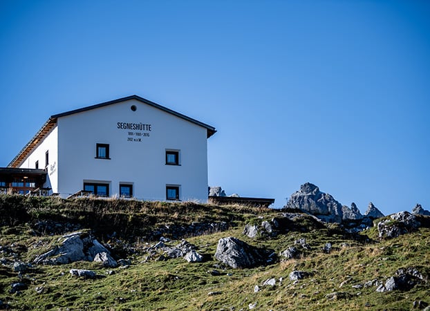
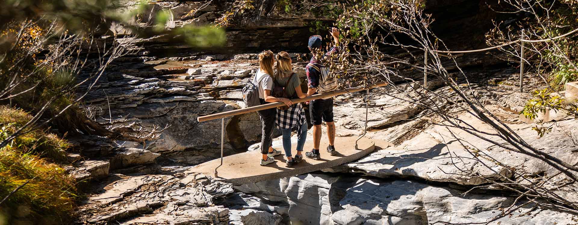
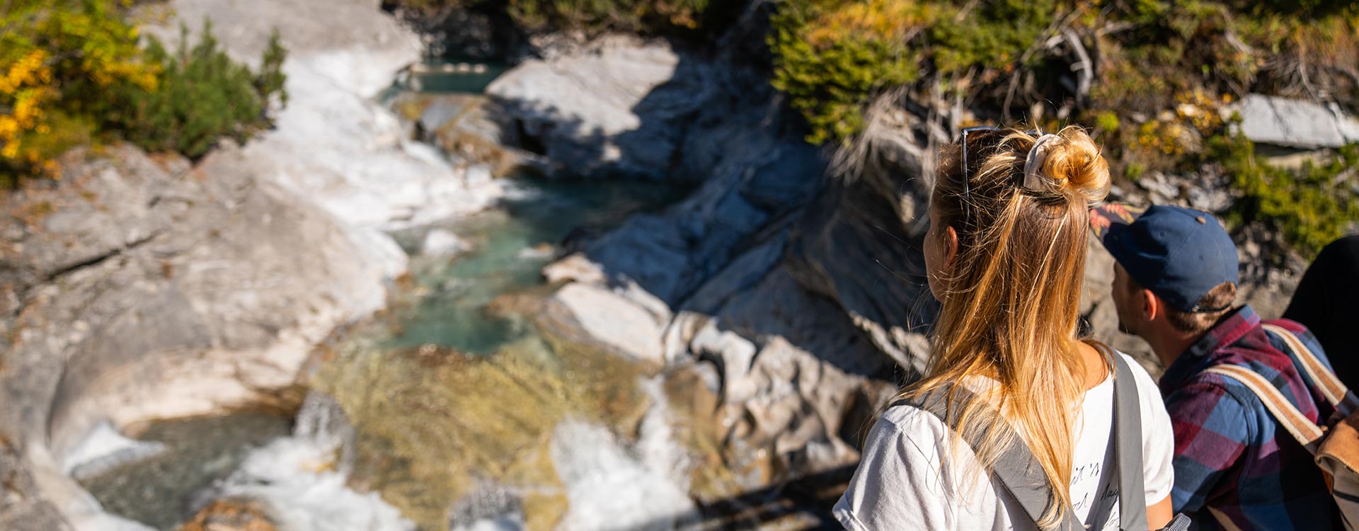
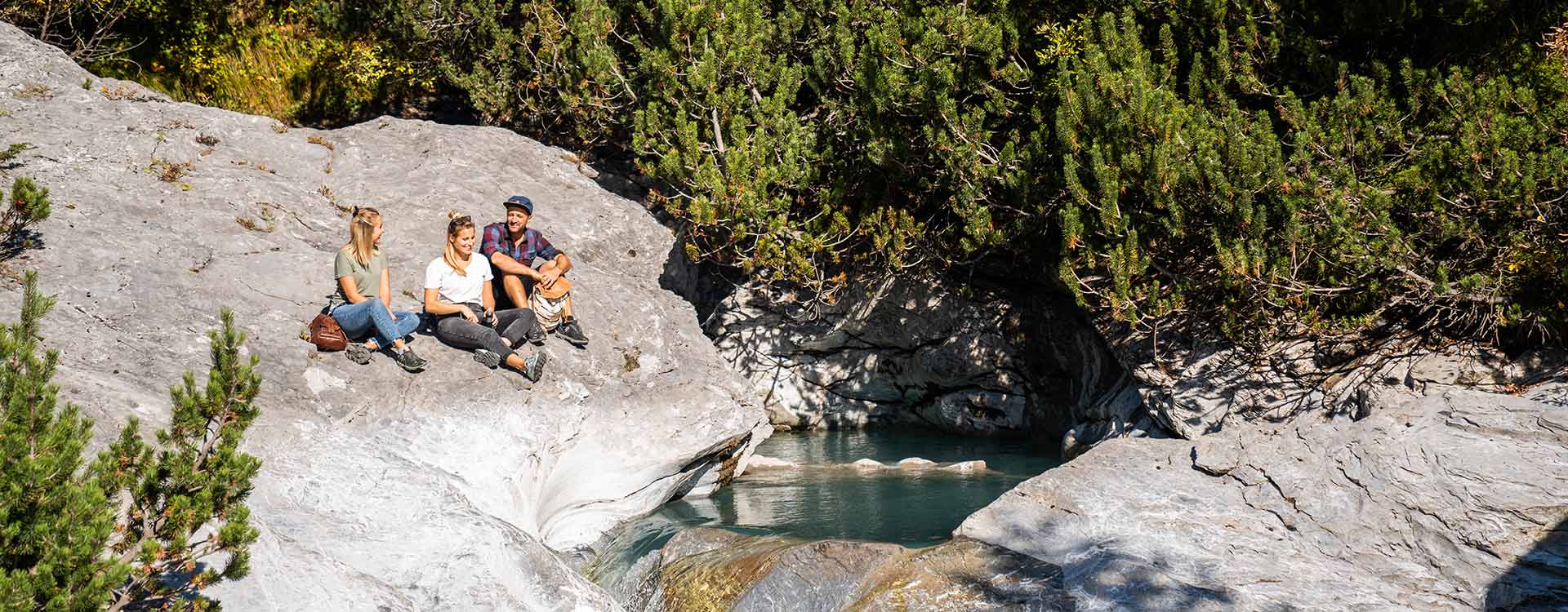
Along the way, you can take a breather from the hike at a number of mountain restaurants (Segneshütte, Startgels) and recharge your batteries with a light snack. From the Segneshütte mountain lodge, you can venture to the upper bridge along the Punt Muletg sper l’Aua plain on the descent. The artificial stone slabs lie almost naturally across the Flem. From here, the trail leads you back and forth along the left and right sides of the gorge, which you cross three times over the upper bridge, the durable wooden bridge and the Pilzfelsen bridge. Here, you can enjoy a wonderful view into the bizarre rock formations of the gorge.
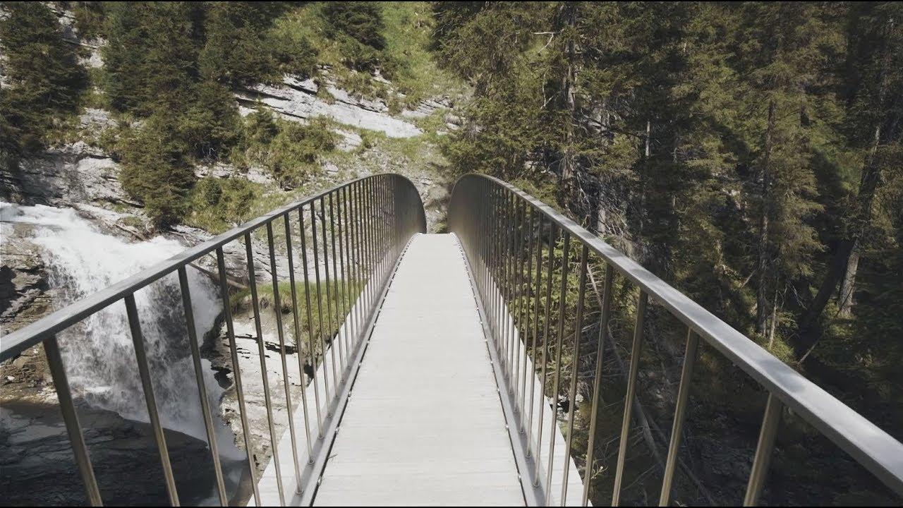
After the Startgels restaurant, the trail leads through wooded slopes across the two wooden bridges Taschlims and Punt da Max. From here, the trail mostly runs alongside the Flem. Looking at the two bridges, you can see how the architect tried to integrate them into the surrounding landscape as well as possible. Before you reach the Foppa mountain restaurant, you will cross the stream using the high waterfall bridge made from Vals gneiss rock just beneath two waterfalls.
From the Foppa mountain restaurant, the trail leads you down to the end of the gorge, where the final bridge – the wooden Muletg bridge – is located. Once you cross this bridge, you will complete the final part of the trail through the Flims forest, which could well be the set of a fairy-tale film. From here, just the final few metres back to the Flims base station via the Runcs car park fork remain.
Trutg dil Flem is a narrow, challenging mountain hiking trail with slopes, bridges and platforms above flowing water. It is important to watch your step on the white/red/white marked trail. Strong hiking shoes and rain gear are necessary. To ensure that you can use the Trutg dil Flem trail as smoothly as possible, please take note of the following important rules:
Trutg dil Flem received the Prix Rando 2014 main prize from the Swiss Hiking Trail Federation in spring 2014, one of the most prestigious awards in Europe for the hiking world. The jury was impressed by this special mountain hiking trail along the Flem stream with its unique combination of art, technology and nature.
Relaxing at home and looking to get in the mood for a beautiful hike? This is possible thanks to our 360° panoramic views. Take a virtual hike and explore the Flims water trail "Trutg dil Flem".