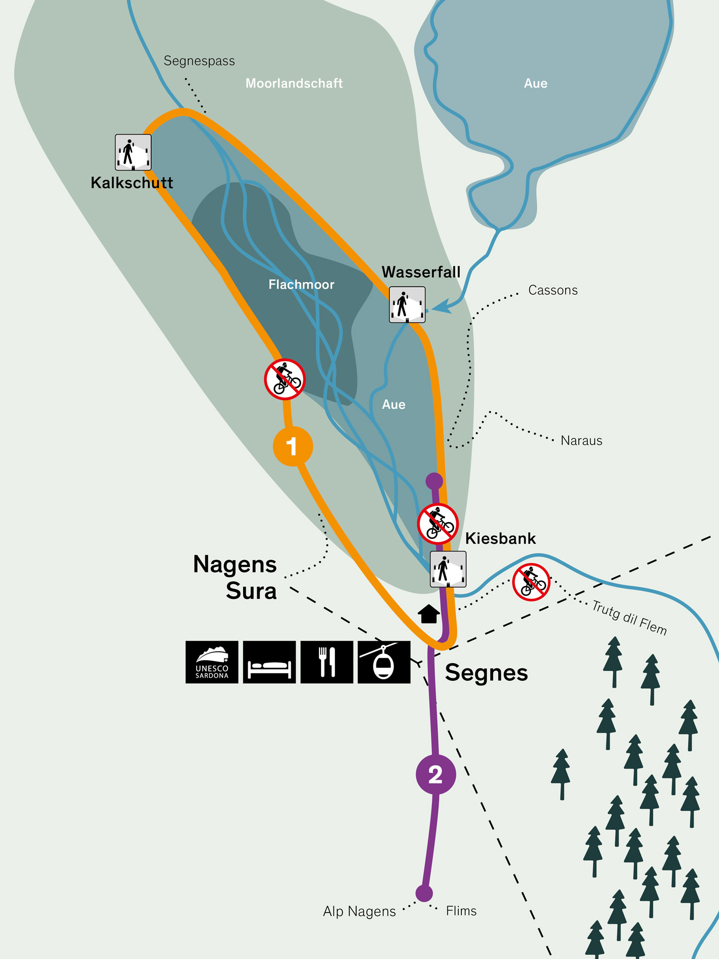
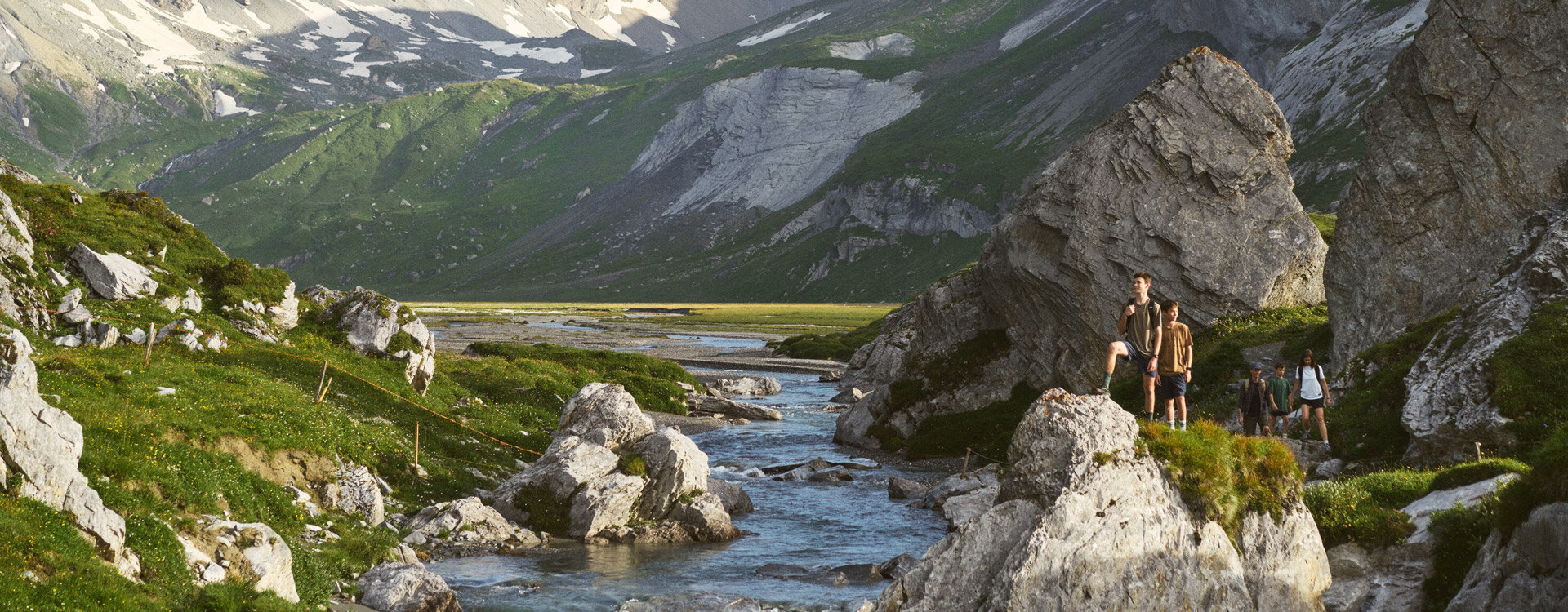
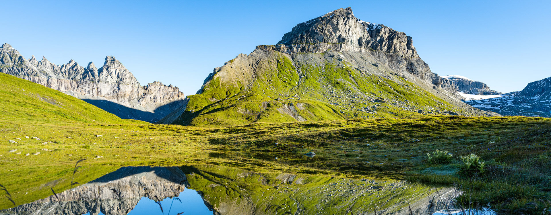
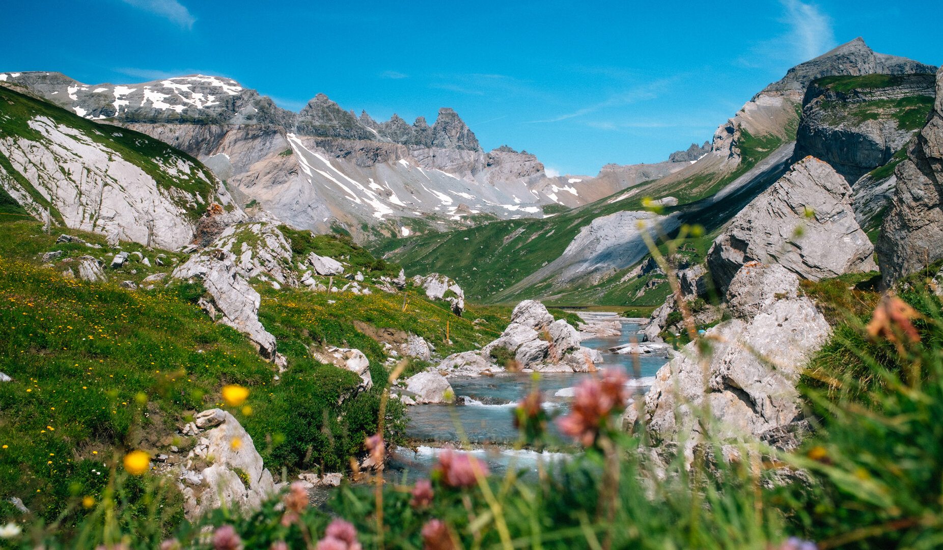
The Segnesböden – «Plaun Segnas Sut» and «Plaun Segnas Sura» – are areas of exceptional natural value. These impressive alluvial plains are enclosed in a basin-shaped landscape, surrounded by steep slopes and rock walls. The Segnes stream plunges from the upper to the lower Segnesboden in an impressive waterfall. Water bodies and wetlands are among the most ecologically valuable habitats. They are home to a wide variety of endangered animal and plant species. For this reason, the last intact areas are now under nature protection. To ensure that these fragile ecosystems are not destroyed, you should stay on the official hiking trail and avoid picking any plants.
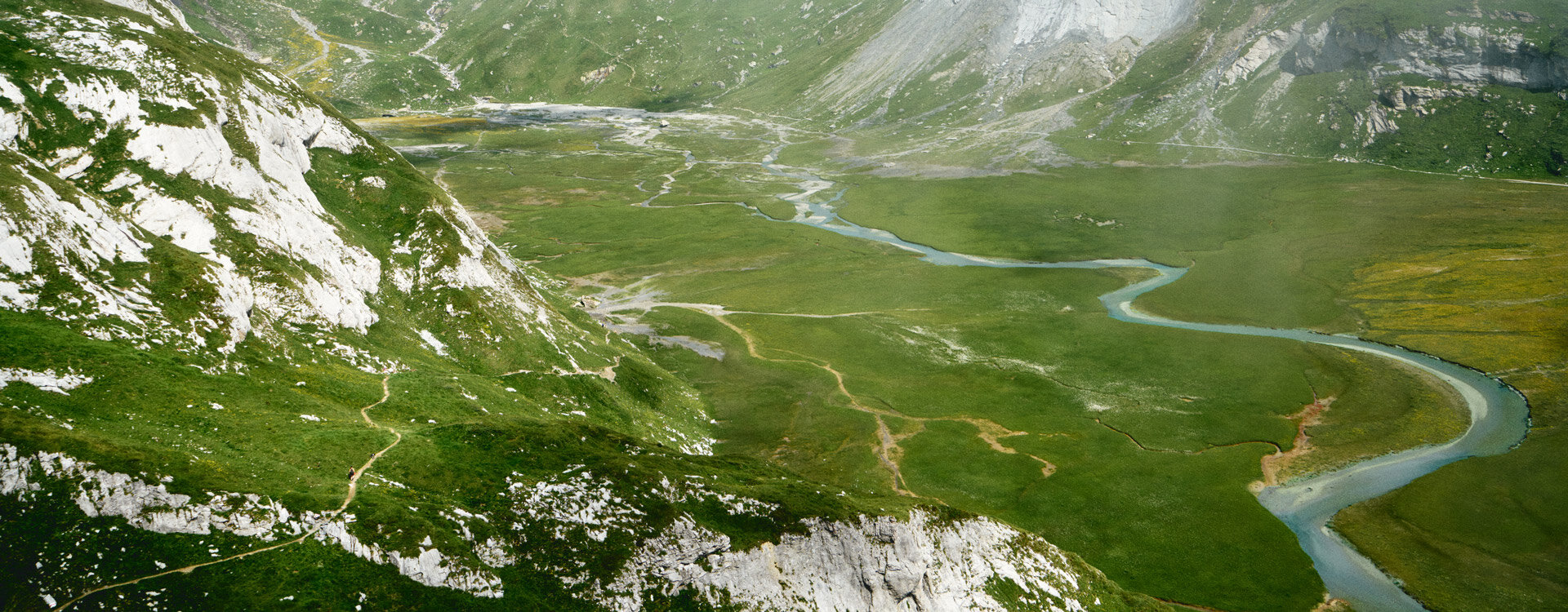
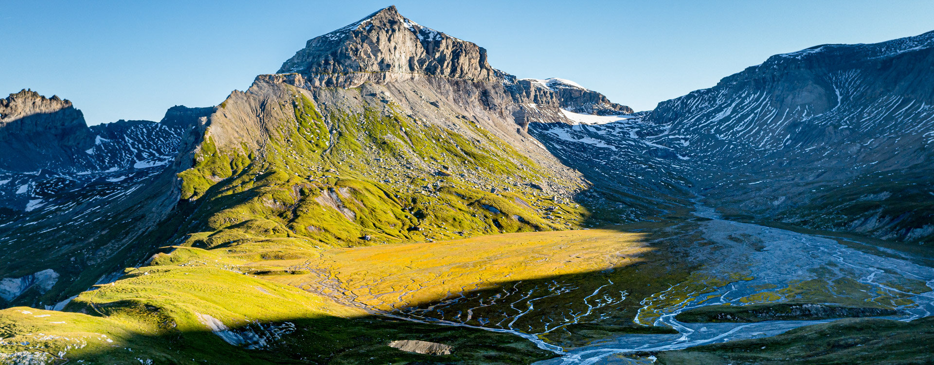
Around 10'000 years ago, after the last ice age, both valleys, which were formed by glaciers, filled with debris brought by the mountain streams. The result was the large alluvial plains of the top and bottom Segnesböden - an exceedingly valuable natural landscape. Scratches caused by the movement of the ice are clearly visible on the rock faces. The two Segnesböden are part of the UNESCO World Natural Heritage Tectonic Arena Sardona.
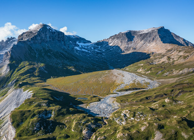
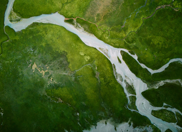
In floodplains – the transitional areas between land and water – it is the flowing water that shapes the landscape. On the lower Segnesboden, there are also two flat moors. Particularly noteworthy is the flat moor in the northern part of the lower Segnesboden. Covering around 25 hectares, it is a remarkable size for this altitude. Due to its high biodiversity and considerable size, this moor is of national importance. The lower Segnesboden is designated as a moorland of particular beauty and of national importance. It is one of the largest moor-covered alluvial plains in Switzerland. The landscape is highly pristine and of outstanding, wild beauty. Particularly remarkable is the dynamic character of this river-shaped landscape.
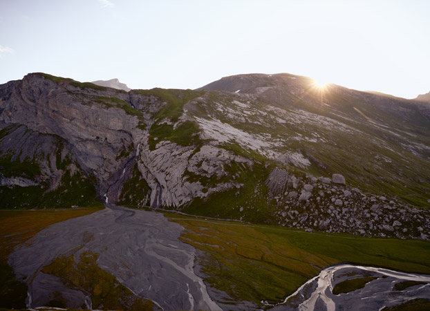
Should you frequently visit the Segnesböden, you will be treated to a slightly different sight each time, as the streams constantly change their course. New streams and small lakes are constantly being created. In floodplains, the areas between land and water, it is flowing water that shapes the landscape. Floodplains are characterised by their wild and natural dynamics. Floodwaters cause erosion (removal of material) and sedimentation (accumulation of material) and thus bring about permanent change. Floods cover areas that were previously dry and create new areas elsewhere, which are then gradually colonised by plants and animals in natural succession. Habitats are destroyed and new ones are created. This dynamic creates an extraordinary diversity of rare species and habitats. The two Segnesböden are extraordinarily beautiful alluvial plains characterised by countless streams. They have been designated floodplains of national importance since 2001 and are under special protection. The upper Segnesboden is mainly formed by the meltwater of the Segnes glacier (glacier forefield). The lower Segnesboden has tributaries that come from all directions.
Moors are formed on an impermeable layer of soil: water can barely run off, leaving the areas constantly wet. Specialised plants that can manage with little nutrients grow in moors. There are two moors on the lower Segnesboden. The moor that lies in the northern part of the lower Segnesboden is particularly noteworthy. It is about 25 hectares in size - a remarkable size for this altitude. Among other things, the moor consists of alpine alluvial floodplains. This rare pioneer community only occurs in the high mountains and in the far north, because the plants do not tolerate temperatures above 25°C. Small marsh ponds can be found here and there. The rest of the area is covered by brown sedge marshes, gravel and sand banks and a small-scale mosaic of typical high alpine vegetation (espalier grasslands with herbaceous willows and alpine azaleas, spring meadows, snow valley communities and alpine grasslands).
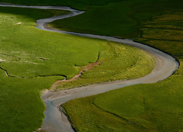
The lower Segnesboden is designated as a moor landscape of particular beauty of national importance. It is one of the largest marshland alluvial plains in Switzerland. The landscape is very pristine and of outstanding, wild beauty. Particularly remarkable is the high dynamic of this landscape shaped by the river.
Peatlands are especially sensitive to trampling. Please use only the marked spots to enter the water. There are three designated places where you can dip your feet. When water levels are low, children can play with the stones along the shore.
Walking distance from Segneshütte along the Senda Segnas Sut:
Gravel bank 10 min. | Waterfall 25 min. | Calcareous debris 45 min.